

“From Yalta to Budapest through the heart of Balkans” crossing Ukraine, Moldova, Romania, Bulgaria, Serbia, Croatia and Hungary is just a little more than 3000 km through a territory characterized by a significant fragmentation in history, nationalities, languages, cultures and religions. A journey, and the occasion at the same time, to see and know a part of Europe often veiled by too a general and unfounded series of prejudices.
29 April - 6 June 2012
39 days - 3036 km
- 29-Apr-2012: Transfer flight Milano - Simferopol
- 30-Apr-2012: Visiting Simferopol, 10 km
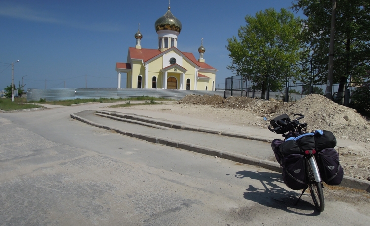
- 01-May-2012: Simferopol – Yalta, 88km, H=1027m
- 02-May-2012: Yalta– Sevastopol, 106km, H=1446m
- 03-May-2012: Sevastopol – Yevpatoriia, 128km,H=776m
- 04-May-2012: Yevpatoriia - Krasnoperekops'k, 120km, H=301m
- 05-May-2012: Krasnoperekops'k – Skadovsk, 98km,H=150m
- 06-May-2012: Skadovsk – Kherson, 110km, H=178m
- 07-May-2012: Kherson – Mykolaiv, 100km, H=405m
- 08-May-2012: Mykolaiv – Koblevo, 90km, H=412m
- 09-May-2012: Koblevo – Odessa, 60km,H=265m
- 10-May-2012: Visiting Odessa, 10km
- 11-May-2012: Odessa - Bilhorod-Dnistrovsky, 90km, H=350m
- 12-May-2012: Bilhorod-Dnistrovsky – Tatarbunary, 82km, H=235m
- 13-May-2012: Tatarbunary – Izmail, 113km,H=448m
- 14-May-2012: Izmail – Galati, 100km,H=425m
- 15-May-2012: Galati - Tulcea, 90km, H=738m
- 16-May-2012: Tulcea - Constanta, 125km, H=987m
- 17-May-2012: Visiting Constanta
- 18-May-2012: Constanta-Ion Corvin, 86km, H=580m
- 19-May-2012: Ion Corvin-Srebarna, 80km, H=584m
- 20-May-2012: Srebarna-Ruse, 106km, H=503m
- 21-May-2012: Ruse-Turnu Magurele, 140km, H=336m
- 22-May-2012: Turnu Magurele-Bechet, 80km, H=130m
- 23-May-2012: Bechet-Calafat, 98km, H=152m
- 24-May-2012: Calafat-Drobeta Tr.Severin, 105km, H=270m
- 25-May-2012: day-off in Drobeta, 20km
- 26-May-2012: Drobeta-Donji Milanovac, 72km, H=360m
- 27-May-2012: Donji Milanovac-Stara Palanca, 100km, H=422m
- 28-May-2012: Stara Palanka-Belgrade, 100km, H=262m
- 29-May-2012: day-off in Belgrade
- 30-May-2012: Belgrade-Novi Sad, 95km, H=433m
- 31-May-2012: Novi Sad-Osijek, 131km, H=396m
- 01-June-2012: Osijek-Baja, 109km, H=144m
- 02-June-2012: Baja-Dunavecse, 103km, H=135m
- 03-June-2012: Dunavecse-Budapest, 101km, 171m
- 04/05-June-2012: Budapest
- 06-June-2012: Transfer flight back to Milano
When we arrived to Simferopol airport the evening of April the 29th, a little bit unexpectedly and definitely surprisingly, at customs we could clear our ”voluminous” baggages without any particular problem; then with two cars we reached our hotel in downtown in a very calm area.
Here, Marina, the hotel tender, gave us a friendly
welcome and showed us where to leave the bicycles for the night.
We took all the day after for preparing the bikes and trying
to get acquainted as much as possible with this new “reality”.
So far, we spent entirely the 30th visiting Simferopol and, on
the following day trying to get out of May the 1st celebrations, we finally, managed to point to
Yalta along the South coast.
The traffic in the between Simferopol and Yalta is the
tipical traffic of an holiday day .... holiday people everywhere.
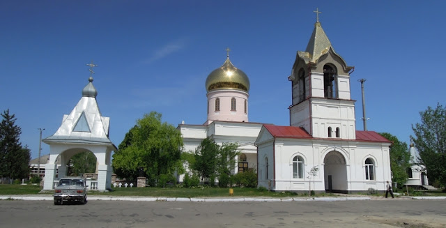
We then spent the night of May the 1st in Yalta where, among
music and ballets we also assisted to some midnight fireworks.
The day after was dedicated to visiting Palace Livadia, the one of the famous “Conference of Yalta” and then in
the afternoon pedalling again in direction of Sevastopol.
We finally spent two days more to reach first Yevpatoriia
and then Krasnoperekops'k.
Here below Piazza Lenin, Simferopol.
Here below Piazza Lenin, Simferopol.


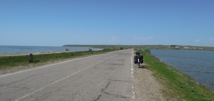
From Yevpatoriya,
and then passing thru the towns of Krasnoperekops’k, Amiansk, Skadovsk and
Kherson the landscape is an endless sequence of huge cultivated fields … with
pretty rare or not farms at all indeed. Getting out of Kherson
and approaching the town of Mykolaïv
From Mykolaïv to Odessa
Along the road just a few villages, a few
churches, some new, some old ones, some other still under construction. Not
many interesting spots indeed, no monumental nor alternative whatsoever scenery
to take pictures of!!
… however small villages sufficient to buy
some food. In the few minimarkets that we encountered it’s amazingly easier to
get beer rather than water.
Up to now we found to sleep everywhere at
an average price of 350 UAH per three persons.
Restaurant menus in the evening are really
tough to understand but, as you can see, we’re still alive.
Price for eating is roughly 100 UAH per
person.
Good enough … the trip continues..


14 May 2012: The Ukranian part of Bessarabia
Getting out ofOdessa
Getting out of
From Bilhorod-Dnistrovsky to Izmail we, so
far, alternated long portions of
important roads to minor country dirty lanes winding up extremely
fertile hilly plains passing through the towns of Tatarbunary and Kiliya.
That’s the so called territory of
southern Bessarabia .
Again, endless cultivated fields with no
farms, no farmers, only microscopic and apparently pretty poor villages of a
few houses. All around nothing but cultivated fields and, here and there, herds of peaceful sheeps,
goats always tryng to get the crispiest
bush leaves, dark cattle grazing the greenest spots.
In the small yards just in front of the
houses some ruspant hens and white ducks.
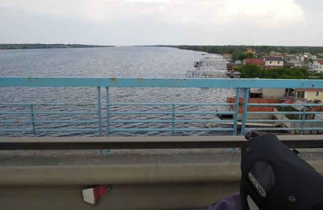
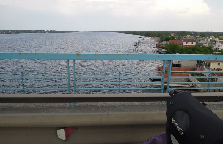
From Izmail to Reni we had to pedal with a
terrible wind in front of us. On the left side we did start to see the Danube and some preliminary views of Romania
Fortunately the passage of the Moldavian
border Reni-Giurgiulesti-Galati has been much faster than expected.


 16 May 2012: Crossing the Romanian portion of Dobruja


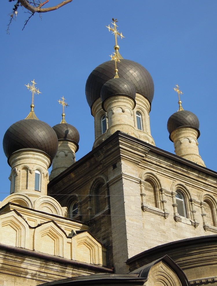
Dobruja is an historical region shared by Bulgaria and Romania, located between the lower Danube river and the Black Sea, including the Danube Delta, the Balck Sea Romanian coast and the northernmost part of the Bulgarian coast.
Its main cities are Constanţa and Tulcea in Romania and Silistra in Bulgaria.


After
The road in the between Galaţi , and Tulcea is a continuous up and down though with some beautiful
views on the Danube .
Tulcea belongs to the Romanian
portion of Dobruja and represents the main port for touristic boat trips on the
Danube delta.
After Tulcea, to follow our step-by-step program, we
pointed directly to Constanța
passing through the little towns of Babadag, Baia, Năvodari,
Ovidiu and Mamaia.
In the between Tulcea and Constanța we followed, with “no-distraction” the DN22, 125 km of contrary wind, heavy traffic, often pretty poor road
conditions and a very terrible continuous up&down!!!
That’s it!! … the trip continues!!


20 May 2012: Entering Bulgaria


To exit the caotic Constanta we followed the DN22C till Murfatlar where we deviated left taking the more pacific DN3. From this point onwards the landscape definitely changes, in better I’d say, offering some relaxing views on the hills that sorround the whole area.
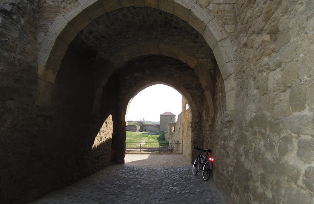
Once in Adamclisi we visited “Tropaeum Traiani” erected to commemorate the Battle of Adamclisi, a major battle in the Dacian Wars, fought in the winter of 101 to 102 between the Roman Empire and the Dacians.
From now on we are (very roughly!) on the EV6 track along the Danube.
Once entered in Bulgaria at Silistra, roads appear to be really excellent with very low traffic and all around an impeccable landscape.
Today, for a second day in a row, we travelled from the very beginnig till the end under a continuous very heavy rain, … and finally now we are in Ruse, again at the border of Romania (Giurgiu).


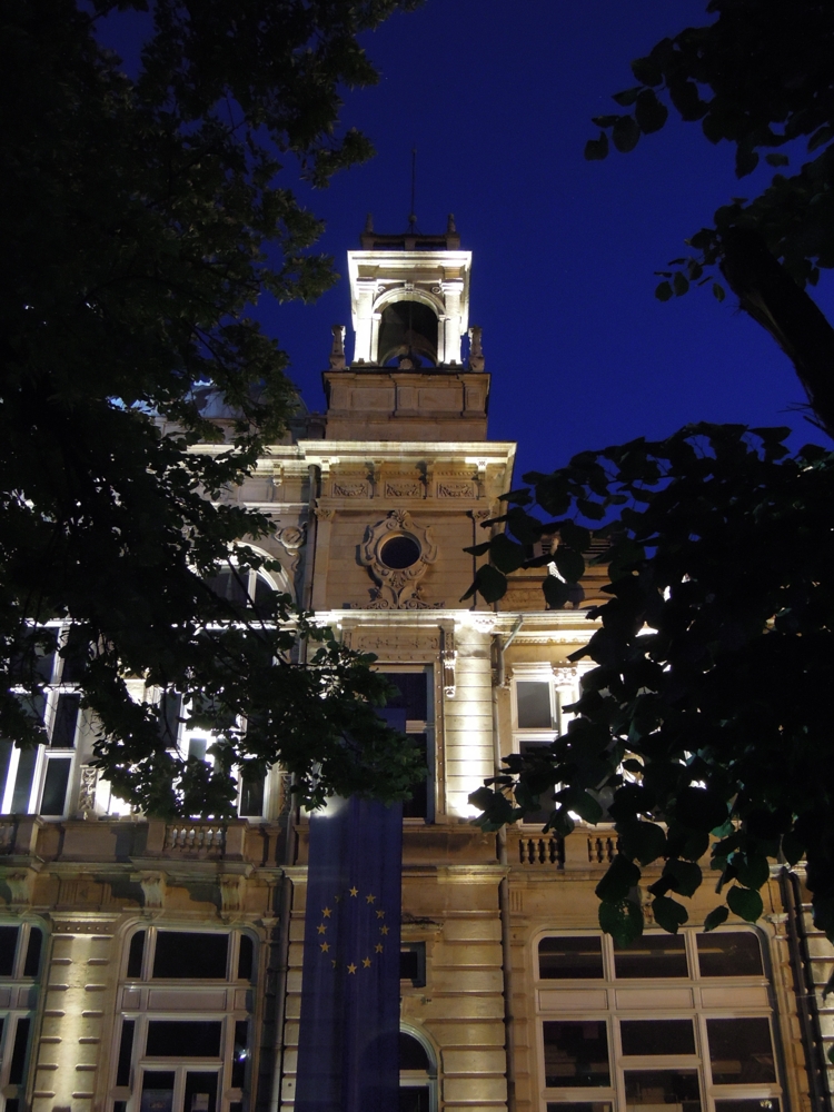


Early in the morning of the 21st we did take another pretty quick sightseeing downtown Ruse (Bulgaria) where we could appreciate its 19th- and 20th-century Neo-Baroque and Neo-Rococo architecture. Later on we took on the direction of Giurgiu (Romania) passing the Friendship Bridge erected in the between 1952 and 1954 during the Communist regime.
After 140 km across a very genuine and “of
other times” country, with people at the border of the roads very happily
drinking and eating sweet loafs in honor of the local saint, we arrived in
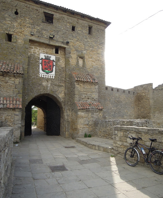
Turnu Magurele, the ancient Roman Castrum “Turris”.
From Turnu Magurele to Bechet, a portual
town facing on the other side of Danube the Bulgarian town of Oryahovo the landscape is almost all the same
… though always quite pleasant and absolutely relaxing.
Today May the 22nd, we stopped
in Bechet.


In the between Bechet, Calafat and Drobeta Tr.Severin we stayed all the time on the left side of the Danube, in the first part getting along minor roads and after Calafat following the pretty straightforward DN56A, trafficated only at the end, roughly 10 km prior to entering Drobeta Tr. Severin. The city, which was called Drobetae by the Romans, took its name of Turnu Severin (meaning the Tower of Severus) from a tower on the north bank of the Danube built by the Byzantines.
"Unfortunately" (for me...) nowadays all the major monumental
buildings of the town seem to be subjected to some substantial restoring
and the few shots that I could take are not the best.
Very interesting however the Castelul de Apa (The Water Castle) an emblematic monument to the people of Severin.
Tomorrow, weather permitting, we’ll pass to Serbia
on the other side of Danube where, very
hopefully, the river will starts to offer some more scenographgic views. Very interesting however the Castelul de Apa (The Water Castle) an emblematic monument to the people of Severin.


29 May 2012: The infernal and monumental Belgrad
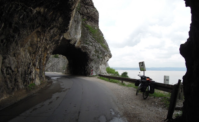
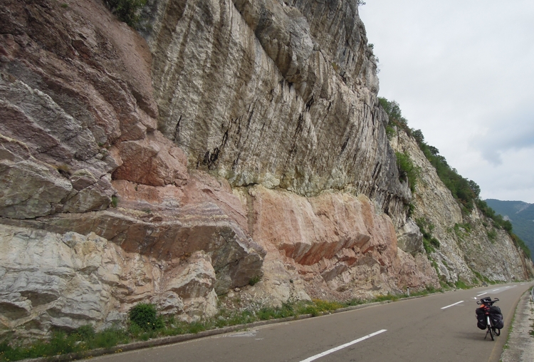
Approximatly 10 km East of Drobeta (Romania) we passed the Romanian-Serbian border in correspondence of the Iron Gate Hydroelectric Power Station (Porţile de Fier). From now on and for over than 200 km the Danube enters in a spectacular gorge till the Ram Fortress situated on a steep slope on the right bank of the river, in themunicipality of Veliko Gradište Belgrade the capital and the largest city of Serbia located at the confluence of the Sava and Danube rivers.
Approximatly 10 km East of Drobeta (Romania) we passed the Romanian-Serbian border in correspondence of the Iron Gate Hydroelectric Power Station (Porţile de Fier). From now on and for over than 200 km the Danube enters in a spectacular gorge till the Ram Fortress situated on a steep slope on the right bank of the river, in the
Very caotic, and dangerous, to cross the bridge on the Danube and then almost impossible to use the bicycle in town due to an infernal traffic and to an absolute absence of any type of cycling lanes.
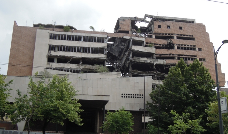
Still very impressive the devastating effects, on some buildings, of the missile attack occurred on May 1, 1999, during the NATO bombing of Yugoslavia


01 June 2012: .. finally to Hungary
Due to different time flight constraints, from now on I’m continuing the trip alone.
Due to different time flight constraints, from now on I’m continuing the trip alone.
So, leaving Novi Sad
early in the morning of May the 31st, I decided to possibly reach Osijek (Croatia Serbia
and Croatia just a couple of
km before Ilok (Serbia
After Ilok I passed thru the devasteted territory of Vukovar
(Croatia ) till reaching Osijek
The day after I decided, for the first
time in this journey, to “totally
abbandon” myself to the guide of the gps. As destination I set Baja (Hungary
I confess, it was simply fantastic, wild
forests and cultivated fields for over 100km.
At a certain point I reached Batina where
at passing the border on the Danube I was convinced to enter Hungary … but with
a great surprise, as the customs officer told me, I was actually
re-entering Serbia.
After approximately 30 km I finally
reached the border with Hungary


From Baja to
Remarkable the stop the past night in Dunavecse at Pension Dália
… truly an horrible room and an horrible breakfast for “only” 6000 Forint !!
Tomorrow
I’ll be packing the bike first and than, after tomorrow … flight back to
Milano.
That’s it, the trip is finished.
That’s it, the trip is finished.


No comments:
Post a Comment